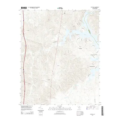
2014 Map of Flint Hill
USGS Topo · Published 2014About this map
Wateree Lake dominates the eastern landscape of this Fairfield County terrain, where the waters of Big Wateree Creek and Dutchmans Creek gather. The topography is defined by a dense network of drainages, including Little Wateree Creek and Horse Br, which carve through the land toward the primary reservoir. Small community clusters like Flint Hill and Bucklick serve as local anchors, connected by a web of rural routes such as Old River Rd and Ladds Ferry Rd.
Find a feature on this map
47 named features on this map. Tap any name to fly to it.
Don’t see what you’re looking for? This feature index may not catch every label — zoom into the map to look around manually.
Map Details
Editions of this 2014 Flint Hill Map
This is the sole edition of this map. No revisions or reprints were ever made.
Other maps of this area

1904 · Columbia
USGS Topo · 1:125,000

1941 · Spartanburg
USGS Topo · 1:250,000

1942 · Camden
USGS Topo · 1:125,000

1953 · Spartanburg
USGS Topo · 1:250,000

1960 · Spartanburg
USGS Topo · 1:250,000

1963 · Spartanburg
USGS Topo · 1:250,000

1964 · Spartanburg
USGS Topo · 1:250,000

1968 · Lancaster SE
USGS Topo · 1:24,000
1969 · Great Falls
USGS Topo · 1:24,000
1969 · Winnsboro
USGS Topo · 1:24,000