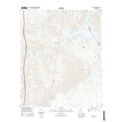
2017 Map of Flint Hill
USGS Topo · Published 2017About this map
Flint Hill and the surrounding Fairfield County countryside are defined by the intricate dendritic drainage systems that feed into the expansive Wateree Lake. This 2017 topographic survey captures the rural character of the region, where family-named roads and ancient creek crossings like Ladd's Ferry Rd intersect with natural landmarks such as Blue Ridge. The landscape is heavily influenced by the presence of Big Wateree Creek and Little Wateree Creek, which meander through the hills alongside thoroughfares like Camp Welfare Rd. For those researching local heritage, the map identifies the Mount Zion Cem and the settlement of Bucklick, providing a contemporary view of these established communities. The detailed topography illustrates the transition from high ground down to the marshy fingers of Dutchmans Creek and Taylor Cr, reflecting the region's enduring relationship with its watercourses.
Find a feature on this map
46 named features on this map. Tap any name to fly to it.
Don’t see what you’re looking for? This feature index may not catch every label — zoom into the map to look around manually.
Map Details
Editions of this 2017 Flint Hill Map
This is the sole edition of this map. No revisions or reprints were ever made.
Other maps of this area

1904 · Columbia
USGS Topo · 1:125,000

1941 · Spartanburg
USGS Topo · 1:250,000

1942 · Camden
USGS Topo · 1:125,000

1953 · Spartanburg
USGS Topo · 1:250,000

1960 · Spartanburg
USGS Topo · 1:250,000

1963 · Spartanburg
USGS Topo · 1:250,000

1964 · Spartanburg
USGS Topo · 1:250,000

1968 · Lancaster SE
USGS Topo · 1:24,000
1969 · Great Falls
USGS Topo · 1:24,000
1969 · Winnsboro
USGS Topo · 1:24,000