
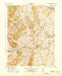
2010 Map of Flint Hill
USGS Topo · Published 2010About this map
Flint Hill anchors the southern portion of this Virginia landscape, where the Jordan River and Rappahannock River flow through a region defined by agricultural estates and named ridges. The map illustrates a contemporary rural structure of large properties and historic crossings, notably Black Rock Ford and Rock Ford. Local history is embedded in labels like Wakefield Manor and the Shenandoah Homesteads Project, alongside smaller settlements such as Huntly, Hume, and Keysville. This 2010 survey reflects a deeply storied Piedmont geography where traditional water features like Pickett Lake and Digulian Pond coexist with modern residential lanes. The terrain is structured by prominent heights, including Rattlesnake Mountain and Buck Mountain, which overlook the winding course of Fiery Run and Hickman Run.
Find a feature on this map
62 named features on this map. Tap any name to fly to it.
Don’t see what you’re looking for? This feature index may not catch every label — zoom into the map to look around manually.
Map Details
Editions of this 2010 Flint Hill Map
This is the sole edition of this map. No revisions or reprints were ever made.
Other maps of this area

1893 · Luray
USGS Topo · 1:125,000

1894 · Warrenton
USGS Topo · 1:125,000

1894 · Warrenton
USGS Topo · 1:62,500

1905 · Luray
USGS Topo · 1:125,000

1927 · Remington
USGS Topo · 1:48,000

1930 · Warrenton
USGS Topo · 1:62,500

1939 · Front Royal
USGS Topo · 1:48,000

1943 · Orlean
USGS Topo · 1:24,000

1943 · Upperville
USGS Topo · 1:24,000
1944 · Upperville
USGS Topo · 1:31,680