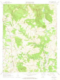
1966 Map of Flint Hill
USGS Topo · Published 1968About this map
The Appalachian Trail traces the northern ridges of this Piedmont landscape, overlooking a network of agricultural valleys and small crossroad settlements. In the mid-1960s, the rural character of the region is defined by the winding course of the Rappahannock River, which forms the border between Rappahannock and Fauquier counties. The map captures the established community of Flint Hill, along with smaller hamlets such as Huntly, Hume, and Cresthill. Notable for genealogists are the numerous family-named terrain features and local landmarks like Wakefield Manor and Willis Chapel.
Find a feature on this map
31 named features on this map. Tap any name to fly to it.
Don’t see what you’re looking for? This feature index may not catch every label — zoom into the map to look around manually.
Map Details
Editions of this 1966 Flint Hill Map
2 editions found
Other maps of this area

1893 · Luray
USGS Topo · 1:125,000

1894 · Warrenton
USGS Topo · 1:125,000

1894 · Warrenton
USGS Topo · 1:62,500

1905 · Luray
USGS Topo · 1:125,000

1927 · Remington
USGS Topo · 1:48,000

1930 · Warrenton
USGS Topo · 1:62,500

1939 · Front Royal
USGS Topo · 1:48,000

1943 · Orlean
USGS Topo · 1:24,000

1943 · Upperville
USGS Topo · 1:24,000
1944 · Upperville
USGS Topo · 1:31,680