
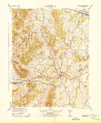
1972 Map of Flint Hill
USGS Topo · Published 1977About this map
Flint Hill and the surrounding Rappahannock County landscape are shown here through 1972 aerial photography. This orthophotoquad captures the transition between the rolling Piedmont and the Blue Ridge foothills, where the settlement of Hume sits at the eastern edge of the quadrangle. The map reflects a rural Virginia economy defined by large-scale field patterns, woodlots, and a network of winding country roads that connect these historic crossroads. Unlike a traditional line-drawn topographic map, this imagery reveals the specific textures of the land as it appeared in the early 1970s, from the density of forest cover to the precise locations of farmhouses and agricultural outbuildings that have long characterized this part of the Commonwealth.
Find a feature on this map
2 named features on this map. Tap any name to fly to it.
Don’t see what you’re looking for? This feature index may not catch every label — zoom into the map to look around manually.
Map Details
Editions of this 1972 Flint Hill Map
This is the sole edition of this map. No revisions or reprints were ever made.
Other maps of this area

1893 · Luray
USGS Topo · 1:125,000

1894 · Warrenton
USGS Topo · 1:125,000

1894 · Warrenton
USGS Topo · 1:62,500

1905 · Luray
USGS Topo · 1:125,000

1927 · Remington
USGS Topo · 1:48,000

1930 · Warrenton
USGS Topo · 1:62,500

1939 · Front Royal
USGS Topo · 1:48,000

1943 · Orlean
USGS Topo · 1:24,000

1943 · Upperville
USGS Topo · 1:24,000
1944 · Upperville
USGS Topo · 1:31,680