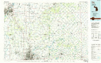
1984 Map of Flint
USGS Topo · Published 1985About this map
The urban centers of Flint and Saginaw anchor this mid-1980s landscape, illustrating the industrial and residential expansion within Genesee Co, Saginaw Co, and Lapeer Co. The map captures the significant water management and recreational infrastructure of the era, including the expansive Holloway Reservoir and the Genesee Recreation Area. Transit networks are well-defined, showing the major corridors of I-75 and I-69 alongside the established routes of the Chesapeake and Ohio RR and Grand Trunk Western RR.
Find a feature on this map
124 named features on this map. Tap any name to fly to it.
Don’t see what you’re looking for? This feature index may not catch every label — zoom into the map to look around manually.
Map Details
Editions of this 1984 Flint Map
This is the sole edition of this map. No revisions or reprints were ever made.
Other maps of this area

1914 · Armada
USGS Topo · 1:62,500

1916 · Bay City
USGS Topo · 1:62,500

1917 · Chesaning
USGS Topo · 1:62,500

1917 · St. Charles
USGS Topo · 1:62,500

1919 · Bay City
USGS Topo · 1:62,500

1919 · Saginaw
USGS Topo · 1:62,500

1919 · Burt
USGS Topo · 1:62,500

1920 · Flint
USGS Topo · 1:62,500

1920 · Holly
USGS Topo · 1:62,500

1921 · Burt
USGS Topo · 1:62,500