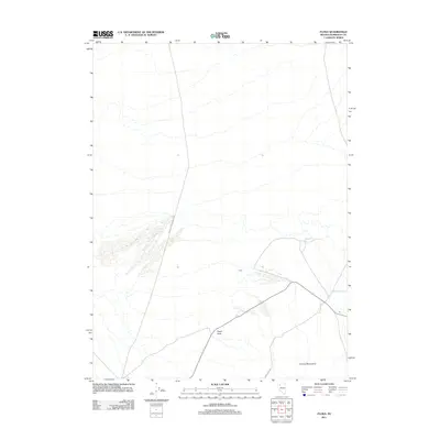
2011 Map of Floka
USGS Topo · Published 2011About this map
Floka sits within the high desert landscape of Humboldt County, characterized by the dramatic rise of the Kamma Mountains in the southeastern quadrant. This 2011 survey reveals a remote landscape defined by isolated water sources and distinctive geological landmarks. Mandalay Spring provides a rare point of hydrography in the arid terrain, while Pulpit Rock serves as a prominent vertical feature north of the mountain range. The infrastructure is sparse, consisting primarily of unpaved routes such as Jackson Creek Ranch Rd and Lewis Camp Rd, which facilitate movement through this section of the Great Basin. The map illustrates a region where human footprint is limited to specific ranching or access roads, leaving much of the environment dominated by natural topographic contours and expansive basins.
Find a feature on this map
6 named features on this map. Tap any name to fly to it.
Don’t see what you’re looking for? This feature index may not catch every label — zoom into the map to look around manually.
Map Details
Editions of this 2011 Floka Map
This is the sole edition of this map. No revisions or reprints were ever made.
Other maps of this area

1886 · Disaster
USGS Topo · 1:250,000

1893 · Disaster
USGS Topo · 1:250,000

1931 · Lovelock
USGS Topo · 1:250,000

1935 · Lovelock
USGS Topo · 1:250,000

1954 · Vya
USGS Topo · 1:250,000

1955 · Lovelock
USGS Topo · 1:250,000

1958 · Vya
USGS Topo · 1:250,000

1959 · Lovelock
USGS Topo · 1:250,000

1962 · Vya
USGS Topo · 1:250,000

1966 · King Lear Peak
USGS Topo · 1:62,500