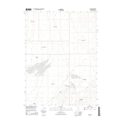
2014 Map of Floka
USGS Topo · Published 2014About this map
The arid landscape of Humboldt County is defined here by the expanse of the Black Rock Desert, where the flat desert floor meets the rising elevations of the Kamma Mountains. In this sparsely populated region of northwestern Nevada, the settlement of Sulphur sits along the southern edge of the desert, while the locality of Floka is positioned further north. These small outposts were historically linked by transit routes through the basin, including Nv-49 and the unpaved Lewis Camp Rd. Significant terrain markers such as Pulpit Rock provide navigational landmarks in a territory where water is a rare and vital resource, represented here by the isolated Mandalay Spring. The map documents the vast section-line grid of the Public Land Survey System, illustrating how land was organized for mining and ranching across the high desert flats.
Find a feature on this map
14 named features on this map. Tap any name to fly to it.
Don’t see what you’re looking for? This feature index may not catch every label — zoom into the map to look around manually.
Map Details
Editions of this 2014 Floka Map
This is the sole edition of this map. No revisions or reprints were ever made.
Other maps of this area

1886 · Disaster
USGS Topo · 1:250,000

1893 · Disaster
USGS Topo · 1:250,000

1931 · Lovelock
USGS Topo · 1:250,000

1935 · Lovelock
USGS Topo · 1:250,000

1954 · Vya
USGS Topo · 1:250,000

1955 · Lovelock
USGS Topo · 1:250,000

1958 · Vya
USGS Topo · 1:250,000

1959 · Lovelock
USGS Topo · 1:250,000

1962 · Vya
USGS Topo · 1:250,000

1966 · King Lear Peak
USGS Topo · 1:62,500