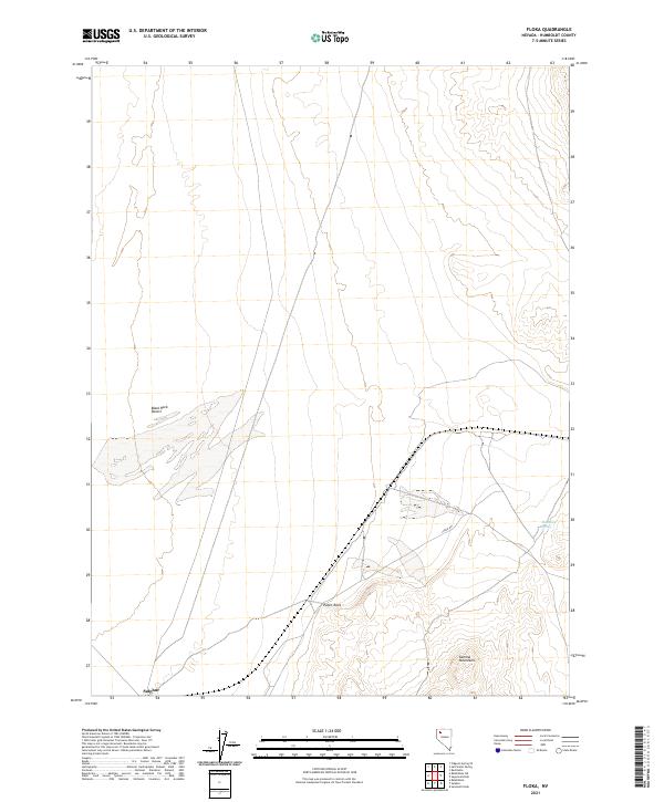
2021 Map of Floka
USGS Topo · Published 2021About this map
Sulphur sits at the southwestern edge of this desert expanse, a location historically defined by its proximity to mineral deposits and the rail lines that served the Great Basin. The landscape transitions from the flats of the Black Rock Desert into the elevated terrain of the Kamma Mountains, where Pulpit Rock serves as a prominent natural landmark. This 2021 edition documents the sparse but vital water sources in an arid environment, specifically Mandalay Spring near the eastern boundary. The road network is dominated by the diagonal stretch of Jungo Rd, a primary transit artery across Humboldt County that follows the traditional path of the old western rail and wagon routes through the basin-and-range province.
Find a feature on this map
12 named features on this map. Tap any name to fly to it.
Don’t see what you’re looking for? This feature index may not catch every label — zoom into the map to look around manually.
Map Details
Editions of this 2021 Floka Map
This is the sole edition of this map. No revisions or reprints were ever made.
Other maps of this area

1886 · Disaster
USGS Topo · 1:250,000

1893 · Disaster
USGS Topo · 1:250,000

1931 · Lovelock
USGS Topo · 1:250,000

1935 · Lovelock
USGS Topo · 1:250,000

1954 · Vya
USGS Topo · 1:250,000

1955 · Lovelock
USGS Topo · 1:250,000

1958 · Vya
USGS Topo · 1:250,000

1959 · Lovelock
USGS Topo · 1:250,000

1962 · Vya
USGS Topo · 1:250,000

1966 · King Lear Peak
USGS Topo · 1:62,500