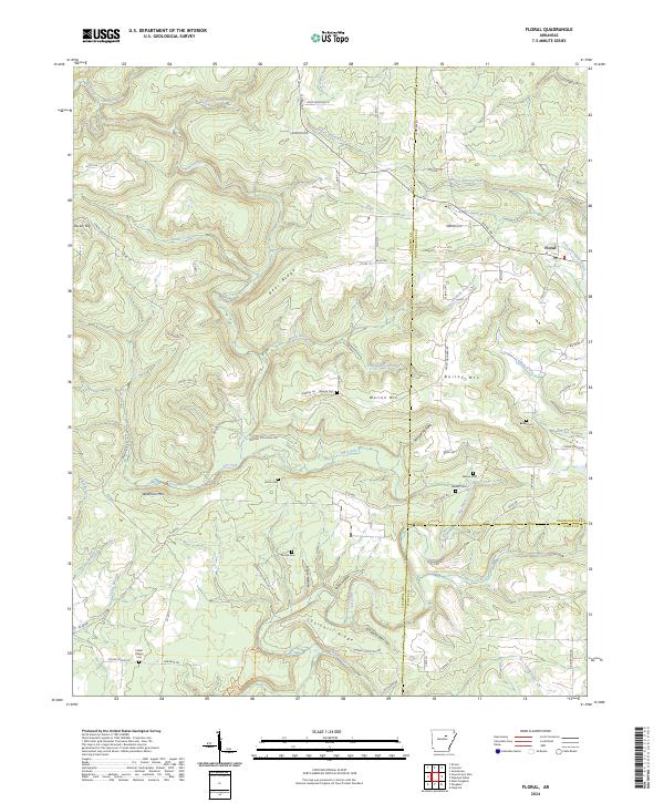
2024 Map of Floral
USGS Topo · Published 2024About this map
Floral sits at the nexus of several creek systems in this upland region of Arkansas, where the landscape is defined by prominent ridges and deep hollows. The settlement pattern is largely dictated by the terrain, with homes and roads clinging to high ground like Bear Ridge and Churchill Ridge or tucked into the narrow valleys of Dry Fork and Wagon Wheel Creek. This map is particularly notable for its high density of family and community burial grounds, including Warren Cem, Bailey Cem, and the Center Chapel Cem in the southwest. These sites, along with landmarks like Warren Mtn and Wideman Mtn, provide a clear picture of established rural life. The borders of Cleburne, Independence, and White Counties converge here, with the local economy reflected in labels like Peach Orchard Rd, indicating the agricultural use of the well-drained slopes.
Find a feature on this map
86 named features on this map. Tap any name to fly to it.
Don’t see what you’re looking for? This feature index may not catch every label — zoom into the map to look around manually.
Map Details
Editions of this 2024 Floral Map
This is the sole edition of this map. No revisions or reprints were ever made.
Other maps of this area

1890 · Batesville
USGS Topo · 1:125,000

1891 · Batesville
USGS Topo · 1:125,000

1935 · Bald Knob
USGS Topo · 1:62,500

1942 · Jamestown
USGS Topo · 1:31,680

1942 · Almond
USGS Topo · 1:31,680

1953 · Memphis
USGS Topo · 1:250,000

1956 · Memphis
USGS Topo · 1:250,000

1962 · Pangburn
USGS Topo · 1:24,000

1963 · West Pangburn
USGS Topo · 1:24,000

1965 · Pleasant Plains
USGS Topo · 1:24,000