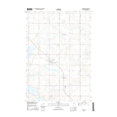
2015 Map of Florence
USGS Topo · Published 2015About this map
Florence anchors this portion of the Coteau des Prairies, a vast plateau rising above the surrounding plains. The settlement is defined by its grid of Main Ave, Kline Ave, and numbered streets, surrounded by an expansive network of rural section lines such as 156th St and 442nd Ave. For genealogists, the map reveals several points of historical interest, including the New Helgen Cem within the town limits, and the more remote Dexter Cem and Helgen Cem to the north. A poignant landmark, the Gautsch Child Grave, sits near 159th St. The hydrology of Codington County is well represented by several prominent water bodies including Dry Lake and Lake Nicholson, alongside smaller wetlands like Sumner Slough, illustrating the post-glacial landscape of the region.
Find a feature on this map
30 named features on this map. Tap any name to fly to it.
Don’t see what you’re looking for? This feature index may not catch every label — zoom into the map to look around manually.
Map Details
Editions of this 2015 Florence Map
This is the sole edition of this map. No revisions or reprints were ever made.
Other maps of this area

1953 · Milbank
USGS Topo · 1:250,000

1953 · Watertown
USGS Topo · 1:250,000

1958 · Milbank
USGS Topo · 1:250,000

1958 · Watertown
USGS Topo · 1:250,000

1969 · Watertown West
USGS Topo · 1:24,000

1970 · Lonesome Lake
USGS Topo · 1:24,000

1970 · Florence NE
USGS Topo · 1:24,000

1970 · Still Lake
USGS Topo · 1:24,000

1973 · Florence
USGS Topo · 1:24,000

1973 · Florence NW
USGS Topo · 1:24,000