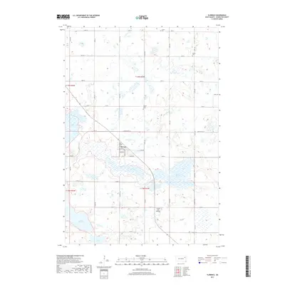
2017 Map of Florence
USGS Topo · Published 2017About this map
Florence anchors this portion of Codington County, situated on a narrow strip of land between the extensive Dry Lake and the smaller Grass Lake. The town's layout is defined by Main Ave and Burnstad Ave, reflecting a typical prairie settlement pattern where the post office (Po) and local infrastructure are concentrated near the lakeshore. The surrounding landscape of the Coteau des Prairies is characterized by a high density of water bodies and wetlands, including Sumner Slough and Lake Nicholson.
Find a feature on this map
41 named features on this map. Tap any name to fly to it.
Don’t see what you’re looking for? This feature index may not catch every label — zoom into the map to look around manually.
Map Details
Editions of this 2017 Florence Map
This is the sole edition of this map. No revisions or reprints were ever made.
Other maps of this area

1953 · Milbank
USGS Topo · 1:250,000

1953 · Watertown
USGS Topo · 1:250,000

1958 · Milbank
USGS Topo · 1:250,000

1958 · Watertown
USGS Topo · 1:250,000

1969 · Watertown West
USGS Topo · 1:24,000

1970 · Lonesome Lake
USGS Topo · 1:24,000

1970 · Florence NE
USGS Topo · 1:24,000

1970 · Still Lake
USGS Topo · 1:24,000

1973 · Florence
USGS Topo · 1:24,000

1973 · Florence NW
USGS Topo · 1:24,000