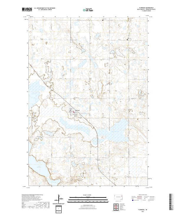
2021 Map of Florence
USGS Topo · Published 2021About this map
Florence occupies the central portion of this Codington County landscape, situated on the vast highland known as the Coteau des Prairies. This glacial plateau is defined by its numerous water bodies, including the expansive Dry Lake south of the town and Grass Lake to the west. The map provides significant genealogical value through its marking of local burial sites, such as the Dexter Cem in the north and both the Helgen Cem and New Helgen Cem. A particularly poignant local landmark is the Gautsch Child Grave located north of the town center. The surrounding terrain is a network of township roads and county routes like Codington Co 43, connecting the scattered prairie depressions of Sumner Slough, Lake Nicholson, and Cooley Lake that characterize this glaciated region.
Find a feature on this map
39 named features on this map. Tap any name to fly to it.
Don’t see what you’re looking for? This feature index may not catch every label — zoom into the map to look around manually.
Map Details
Editions of this 2021 Florence Map
This is the sole edition of this map. No revisions or reprints were ever made.
Other maps of this area

1953 · Milbank
USGS Topo · 1:250,000

1953 · Watertown
USGS Topo · 1:250,000

1958 · Milbank
USGS Topo · 1:250,000

1958 · Watertown
USGS Topo · 1:250,000

1969 · Watertown West
USGS Topo · 1:24,000

1970 · Lonesome Lake
USGS Topo · 1:24,000

1970 · Florence NE
USGS Topo · 1:24,000

1970 · Still Lake
USGS Topo · 1:24,000

1973 · Florence
USGS Topo · 1:24,000

1973 · Florence NW
USGS Topo · 1:24,000