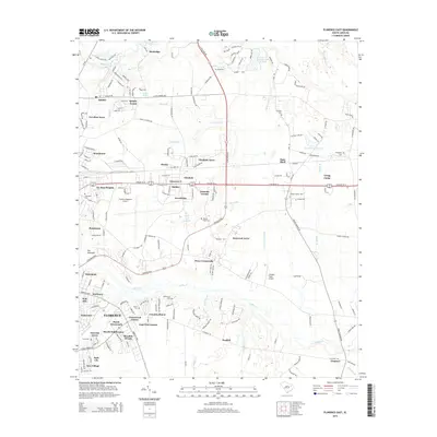
2014 Map of Florence East
USGS Topo · Published 2014About this map
The eastern edges of Florence and its surrounding communities are documented here as they appeared in 2014, showing a landscape defined by expanding residential subdivisions and critical regional infrastructure. The transition from the urban core to the rural reaches of Florence County is marked by several named neighborhoods, including Greenwood Estates, East View Estates, and Glendale Acres. Public life and education are centered at Francis Marion Univ and the sprawling Florence Regional Airport, which dominates the central portion of the map.
Find a feature on this map
87 named features on this map. Tap any name to fly to it.
Don’t see what you’re looking for? This feature index may not catch every label — zoom into the map to look around manually.
Map Details
Editions of this 2014 Florence East Map
This is the sole edition of this map. No revisions or reprints were ever made.
Other maps of this area

1940 · Florence West
USGS Topo · 1:62,500

1940 · Florence East
USGS Topo · 1:62,500

1943 · Gum Swamp
USGS Topo · 1:62,500

1945 · Florence East
USGS Topo · 1:62,500

1945 · Florence West
USGS Topo · 1:62,500

1953 · Florence
USGS Topo · 1:250,000

1954 · Florence
USGS Topo · 1:250,000

1963 · Darlington East
USGS Topo · 1:24,000
1972 · Oak Grove
USGS Topo · 1:24,000
1972 · Witherspoon Island
USGS Topo · 1:24,000