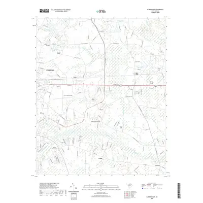
2020 Map of Florence East
USGS Topo · Published 2020About this map
Florence Regional Airport and the campus of Francis Marion University anchor this portion of the Pee Dee region, showing the eastern expansion of Florence into a landscape defined by extensive wetlands. The terrain is dominated by the complex drainage systems of Polk Swamp and Jeffries Creek, where numerous small tributaries like Ashby Branch and Adams Branch feed into larger water bodies.
Find a feature on this map
74 named features on this map. Tap any name to fly to it.
Don’t see what you’re looking for? This feature index may not catch every label — zoom into the map to look around manually.
Map Details
Editions of this 2020 Florence East Map
This is the sole edition of this map. No revisions or reprints were ever made.
Other maps of this area

1940 · Florence West
USGS Topo · 1:62,500

1940 · Florence East
USGS Topo · 1:62,500

1943 · Gum Swamp
USGS Topo · 1:62,500

1945 · Florence East
USGS Topo · 1:62,500

1945 · Florence West
USGS Topo · 1:62,500

1953 · Florence
USGS Topo · 1:250,000

1954 · Florence
USGS Topo · 1:250,000

1963 · Darlington East
USGS Topo · 1:24,000
1972 · Oak Grove
USGS Topo · 1:24,000
1972 · Witherspoon Island
USGS Topo · 1:24,000