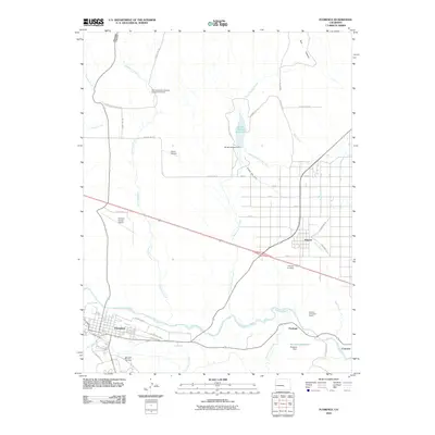
2010 Map of Florence
USGS Topo · Published 2010About this map
The Arkansas River carves a central path through this landscape, anchoring a network of industrial and agricultural infrastructure in Fremont County. On the southern banks, the city of Florence sits near a complex web of irrigation and drainage features, including the Union Ditch, Oak Creek, and Coal Creek. To the east, the industrial character of the region is evident at Portland, where the Portland Limestone Quarry, Portland Dam, and Portland Reservoir speak to the local resource extraction and water management history. Further downstream, the small settlement of Concrete marks the edge of the survey area.
Find a feature on this map
48 named features on this map. Tap any name to fly to it.
Don’t see what you’re looking for? This feature index may not catch every label — zoom into the map to look around manually.
Map Details
Editions of this 2010 Florence Map
This is the sole edition of this map. No revisions or reprints were ever made.
Other maps of this area

1889 · Canon City
USGS Topo · 1:125,000

1891 · Pueblo
USGS Topo · 1:125,000

1892 · Canon City
USGS Topo · 1:125,000

1893 · Colorado Springs
USGS Topo · 1:125,000

1894 · Pikes Peak
USGS Topo · 1:125,000

1894 · Pueblo
USGS Topo · 1:125,000

1896 · Pueblo
USGS Topo · 1:125,000

1897 · Pueblo
USGS Topo · 1:125,000

1901 · Pikes Peak
USGS Topo · 1:125,000

1909 · Colorado Springs
USGS Topo · 1:125,000