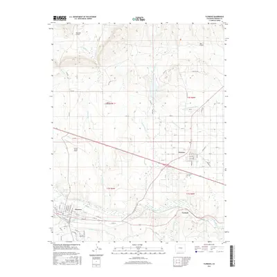
2016 Map of Florence
USGS Topo · Published 2016About this map
Florence and Penrose anchor this 2016 survey of the Fremont County landscape, where the Arkansas River carves a path through a region defined by complex irrigation and aviation. The map details a sophisticated water-management system essential to this semi-arid environment, including the Brush Hollow Reservoir, Beaver Park Ditch, and the Minnequa Canal. These features reflect a legacy of engineering that supports both local industry and agriculture. To the north, the terrain transitions into the steep relief of Phantom Canyon and Box Canyon, while the aviation needs of the area are served by both the Fremont County Airport and the smaller Braun Airport. Genealogists will find the locations of the Penrose Cem and San Juan Bautista Cem clearly marked. The industrial site at Portland further illustrates the varied economic uses of the river valley, from transportation to resource management.
Find a feature on this map
83 named features on this map. Tap any name to fly to it.
Don’t see what you’re looking for? This feature index may not catch every label — zoom into the map to look around manually.
Map Details
Editions of this 2016 Florence Map
This is the sole edition of this map. No revisions or reprints were ever made.
Other maps of this area

1889 · Canon City
USGS Topo · 1:125,000

1891 · Pueblo
USGS Topo · 1:125,000

1892 · Canon City
USGS Topo · 1:125,000

1893 · Colorado Springs
USGS Topo · 1:125,000

1894 · Pikes Peak
USGS Topo · 1:125,000

1894 · Pueblo
USGS Topo · 1:125,000

1896 · Pueblo
USGS Topo · 1:125,000

1897 · Pueblo
USGS Topo · 1:125,000

1901 · Pikes Peak
USGS Topo · 1:125,000

1909 · Colorado Springs
USGS Topo · 1:125,000