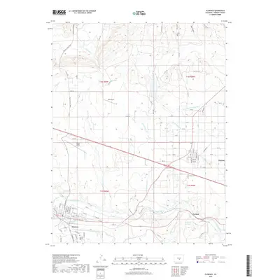
2019 Map of Florence
USGS Topo · Published 2019About this map
Florence and its surrounding industrial and agricultural landscape sit along the banks of the Arkansas River in this modern survey. The map details the complex irrigation and water management systems vital to the region, including the Union Ditch, Minnequa Canal, and the Beaver Park Ditch. These waterways support the varied settlements of Portland, known for its industrial connection to the Portland Reservoir, and the planned grid of Penrose. Genealogists will find the San Juan Bautista Cem south of Florence and the Penrose Cem near the town's southern edge particularly useful for local research.
Find a feature on this map
87 named features on this map. Tap any name to fly to it.
Don’t see what you’re looking for? This feature index may not catch every label — zoom into the map to look around manually.
Map Details
Editions of this 2019 Florence Map
This is the sole edition of this map. No revisions or reprints were ever made.
Other maps of this area

1889 · Canon City
USGS Topo · 1:125,000

1891 · Pueblo
USGS Topo · 1:125,000

1892 · Canon City
USGS Topo · 1:125,000

1893 · Colorado Springs
USGS Topo · 1:125,000

1894 · Pikes Peak
USGS Topo · 1:125,000

1894 · Pueblo
USGS Topo · 1:125,000

1896 · Pueblo
USGS Topo · 1:125,000

1897 · Pueblo
USGS Topo · 1:125,000

1901 · Pikes Peak
USGS Topo · 1:125,000

1909 · Colorado Springs
USGS Topo · 1:125,000