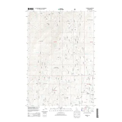
2013 Map of Florence
USGS Topo · Published 2013About this map
Florence sits at the heart of this Idaho County survey, situated within the Nez Perce National Forest at the head of the Florence Basin. The area is marked by its mining-era legacy, with gold-bearing drainages like Miller Creek and Gold Lake Creek carving through the high mountain terrain. Named gulches such as Pioneer Gulch, Baboon Gulch, and Humbug Gulch radiate from the central settlement, hinting at the prospecting history that defined this landscape. The Florence Cemetery remains a significant genealogical landmark, while outlying sites like Moon Cabin, Bungalow Cow Camp, and the area near Sampson show the dispersed nature of mountain habitation. High ridges like Telephone Ridge separate the various watersheds, including Slate Creek and the forks of Meadow Creek, illustrating the challenging geography of this remote territory.
Find a feature on this map
119 named features on this map. Tap any name to fly to it.
Don’t see what you’re looking for? This feature index may not catch every label — zoom into the map to look around manually.
Map Details
Editions of this 2013 Florence Map
This is the sole edition of this map. No revisions or reprints were ever made.
Other maps of this area

1931 · Buffalo Hump
USGS Topo · 1:125,000

1934 · Buffalo Hump
USGS Topo · 1:125,000

1938 · Riggins
USGS Topo · 1:96,000

1945 · Riggins
USGS Topo · 1:125,000

1955 · Grangeville
USGS Topo · 1:250,000

1956 · Burgdorf
USGS Topo · 1:62,500

1956 · Elk City
USGS Topo · 1:250,000

1959 · Grangeville
USGS Topo · 1:250,000

1960 · Elk City
USGS Topo · 1:250,000

1963 · John Day Mtn
USGS Topo · 1:24,000