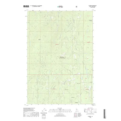
2020 Map of Florence
USGS Topo · Published 2020About this map
Florence sits at the heart of a historically significant mining landscape within the Nez Perce National Forest. This high-elevation terrain is defined by the Florence Basin, where numerous drainages and gulches speak to the area's gold-rush heritage. Landmarks such as Pioneer Gulch, Humbug Gulch, and Baboon Gulch surround the townsite, while the Florence Cem remains a quiet witness to the district's past. The drainage network is complex, with Little Slate Cr and Little French Cr carving through the plateau. To the north, Telephone Ridge provides a prominent divide between the watersheds of Deadhorse Cr and the various branches of Slate Cr. Much of the map's western half is dominated by these steep ridges, while the eastern portion opens into the Round Bottom Meadows near Big Boulder Cr, illustrating the stark transition from narrow gulches to wider alpine meadows.
Find a feature on this map
50 named features on this map. Tap any name to fly to it.
Don’t see what you’re looking for? This feature index may not catch every label — zoom into the map to look around manually.
Map Details
Editions of this 2020 Florence Map
This is the sole edition of this map. No revisions or reprints were ever made.
Other maps of this area

1931 · Buffalo Hump
USGS Topo · 1:125,000

1934 · Buffalo Hump
USGS Topo · 1:125,000

1938 · Riggins
USGS Topo · 1:96,000

1945 · Riggins
USGS Topo · 1:125,000

1955 · Grangeville
USGS Topo · 1:250,000

1956 · Burgdorf
USGS Topo · 1:62,500

1956 · Elk City
USGS Topo · 1:250,000

1959 · Grangeville
USGS Topo · 1:250,000

1960 · Elk City
USGS Topo · 1:250,000

1963 · John Day Mtn
USGS Topo · 1:24,000