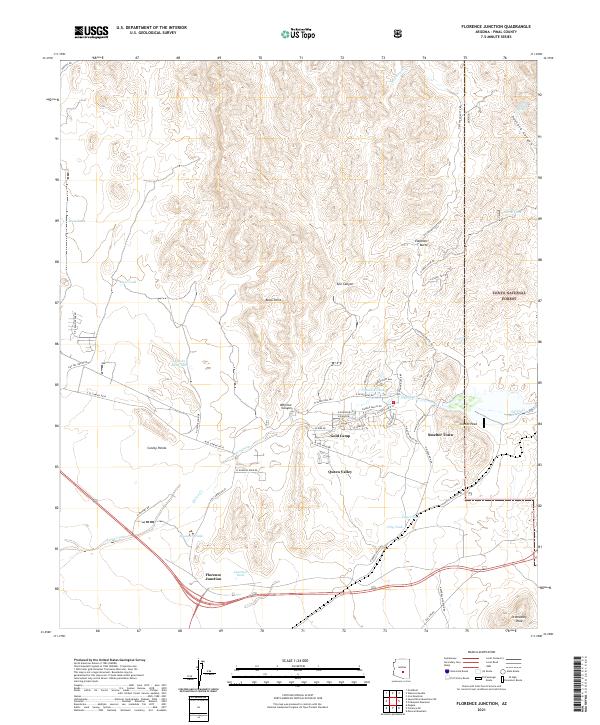
2021 Map of Florence Junction
USGS Topo · Published 2021About this map
Queen Valley and its surrounding desert foothills represent a pocket of modern settlement amidst the sharp topography of Pinal County. This 2021 study shows the organized residential street grid of the valley south of Whitlow Canyon, contrasting with the more dispersed mining-inflected sites like Gold Camp and Smelter Town to the east. The landscape is defined by its water management, evidenced by numerous tanks such as Whitlow Tank and Junction Tank that supported cattle and local industry in an arid environment.
Find a feature on this map
69 named features on this map. Tap any name to fly to it.
Don’t see what you’re looking for? This feature index may not catch every label — zoom into the map to look around manually.
Map Details
Editions of this 2021 Florence Junction Map
This is the sole edition of this map. No revisions or reprints were ever made.
Other maps of this area

1900 · Florence
USGS Topo · 1:125,000

1902 · Florence
USGS Topo · 1:125,000

1948 · Superior
USGS Topo · 1:62,500

1948 · Iron Mountain
USGS Topo · 1:24,000

1948 · Picketpost Mtn
USGS Topo · 1:24,000

1949 · Iron Mountain
USGS Topo · 1:24,000

1949 · Picketpost Mtn
USGS Topo · 1:24,000

1954 · Mesa
USGS Topo · 1:250,000

1956 · Goldfield
USGS Topo · 1:24,000

1956 · Magma
USGS Topo · 1:24,000