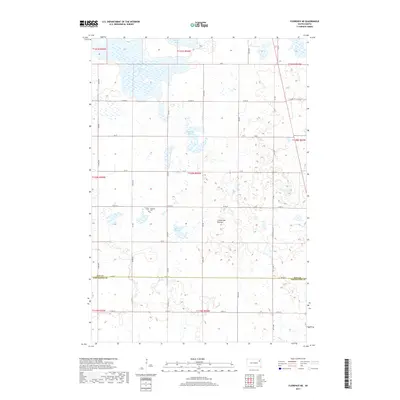
2017 Map of Florence NE
USGS Topo · Published 2017About this map
The Coteau des Prairies upland plateau dominates this portion of northeastern South Dakota, shaping a landscape defined by glacial activity and numerous water bodies. In the northern sections, Bitter Lake and Goose Lake are prominent aquatic features, while the central terrain is marked by smaller basins including Foldager Slough and Arneson Slough. This region, crossing the boundary between Day and Codington counties, preserves a rural agricultural character structured by a rigid section-line road network such as Co Rd 30 and Co Rd 36. For genealogists and local historians, the map identifies two specific burial sites in the central-western portion: Lindaas Cem and Egeland Cem. These landmarks, along with the scattered farmstead footprints, provide a detailed look at the settlement pattern of Eden Township and the surrounding prairie during the early twenty-first century.
Find a feature on this map
25 named features on this map. Tap any name to fly to it.
Don’t see what you’re looking for? This feature index may not catch every label — zoom into the map to look around manually.
Map Details
Editions of this 2017 Florence NE Map
This is the sole edition of this map. No revisions or reprints were ever made.
Other maps of this area

1953 · Milbank
USGS Topo · 1:250,000

1958 · Milbank
USGS Topo · 1:250,000

1970 · Lonesome Lake
USGS Topo · 1:24,000

1970 · Waubay
USGS Topo · 1:24,000

1970 · Florence NE
USGS Topo · 1:24,000

1970 · Waubay SW
USGS Topo · 1:24,000

1970 · Ortley
USGS Topo · 1:24,000

1970 · Still Lake
USGS Topo · 1:24,000

1973 · Florence
USGS Topo · 1:24,000

1973 · Florence NW
USGS Topo · 1:24,000