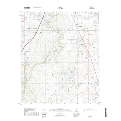
2020 Map of Florence
USGS Topo · Published 2020About this map
The Pearl River corridor south of Jackson defines this region of Hinds and Rankin Counties, where suburban development meets the bottomlands. The landscape is marked by a complex network of waterways, including Steamboat Slough, Richland Creek, and numerous small lakes such as Lake Bonnie Webb and Lake Mitchell. Higher ground is found at Stewarts Bluff and Tucker Bluff, overlooking the river valley. The map documents the growth of established communities like Pearl, Richland, and Florence, while also noting smaller settlements such as Nogan and Elton. For those tracing local heritage, several burial grounds are scattered throughout the area, including Lakewood Memorial Park South Cem, Richland Cem, and the remote Smith Cem. This era of the landscape shows a dense grid of residential expansion in Lakeland and Plainview contrasted against the meandering, wooded reaches of Howard Creek.
Find a feature on this map
183 named features on this map. Tap any name to fly to it.
Don’t see what you’re looking for? This feature index may not catch every label — zoom into the map to look around manually.
Map Details
Editions of this 2020 Florence Map
This is the sole edition of this map. No revisions or reprints were ever made.
Other maps of this area

1903 · Jackson
USGS Topo · 1:125,000

1905 · Jackson
USGS Topo · 1:48,000

1906 · Florence
USGS Topo · 1:62,500

1908 · Jackson
USGS Topo · 1:62,500

1908 · Florence
USGS Topo · 1:62,500

1934 · Raymond
USGS Topo · 1:48,000

1937 · Raymond
USGS Topo · 1:62,500

1937 · Terry
USGS Topo · 1:48,000

1942 · Raymond
USGS Topo · 1:62,500

1943 · Terry
USGS Topo · 1:62,500