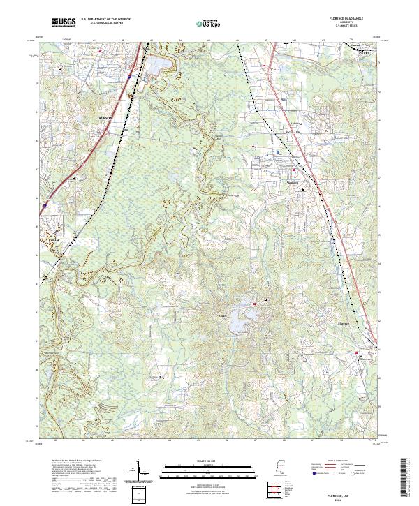
2024 Map of Florence
USGS Topo · Published 2024About this map
Florence and the surrounding Rankin County landscape are defined by the winding course of the Pearl River, which forms a natural boundary with Hinds County to the west. This modern survey illustrates the suburban expansion of Richland and Pearl south of Jackson, while maintaining pockets of rural heritage and family burial grounds such as McGowen Cem and Smith Cem. The river's influence is evident in named landmarks like Cooks Ferry, Wansley Bend, and the elevated Stewarts Bluff, suggesting the historic importance of the waterway for crossing and navigation before modern bridge infrastructure dominated the region.
Find a feature on this map
193 named features on this map. Tap any name to fly to it.
Don’t see what you’re looking for? This feature index may not catch every label — zoom into the map to look around manually.
Map Details
Editions of this 2024 Florence Map
This is the sole edition of this map. No revisions or reprints were ever made.
Other maps of this area

1903 · Jackson
USGS Topo · 1:125,000

1905 · Jackson
USGS Topo · 1:48,000

1906 · Florence
USGS Topo · 1:62,500

1908 · Jackson
USGS Topo · 1:62,500

1908 · Florence
USGS Topo · 1:62,500

1934 · Raymond
USGS Topo · 1:48,000

1937 · Raymond
USGS Topo · 1:62,500

1937 · Terry
USGS Topo · 1:48,000

1942 · Raymond
USGS Topo · 1:62,500

1943 · Terry
USGS Topo · 1:62,500