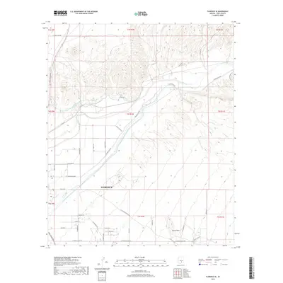
2018 Map of Florence SE
USGS Topo · Published 2018About this map
Florence serves as the focal point of this desert landscape, where the managed waters of the Gila River meet modern infrastructure in Pinal County. The map clearly illustrates the extensive path of the Central Arizona Project Aqueduct, which cuts diagonally across the terrain, a vital artery for water distribution in the arid West. The topography transitions from the alluvial plains around the town to the distinct formations of Picture Rocks in the southeast. A complex network of rural and industrial roads, such as E Diversion Dam Rd and Pinal Pioneer Pkwy, highlights the area's development. Local history is etched into the landscape through features like China Wash and the traditional routes of the E Florence-Kelvin Hwy, showing how the community has organized itself around both natural washes and large-scale engineering projects.
Find a feature on this map
42 named features on this map. Tap any name to fly to it.
Don’t see what you’re looking for? This feature index may not catch every label — zoom into the map to look around manually.
Map Details
Editions of this 2018 Florence SE Map
This is the sole edition of this map. No revisions or reprints were ever made.
Other maps of this area

1900 · Florence
USGS Topo · 1:125,000

1902 · Florence
USGS Topo · 1:125,000

1922 · Red Rock No 2
USGS Topo · 1:48,000

1934 · Newman Peak
USGS Topo · 1:125,000

1954 · Mesa
USGS Topo · 1:250,000

1956 · Magma
USGS Topo · 1:24,000

1956 · Tucson
USGS Topo · 1:250,000

1957 · Mesa
USGS Topo · 1:250,000

1958 · Mesa
USGS Topo · 1:250,000

1958 · Tucson
USGS Topo · 1:250,000