2016 Map of Florence
USGS Topo · Published 2016About this map
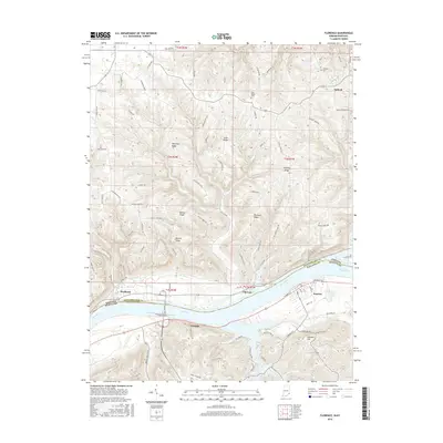
The Ohio River carves a deep valley between the Kentucky and Indiana borderlands, serving as the central artery for this riverfront landscape. On the southern bank, the town of Warsaw is organized around a grid of streets including West Main Street and East Main Street, while the smaller settlement of Florence sits just downstream. Across the water, the Indiana topography is defined by sharp elevation changes and high points such as Pleasant Ridge and Scott Ridge. These uplands are home to rural communities like Antioch and the historic Antioch Cemetery. The rugged terrain north of the river is bisected by numerous drainages, notably Log Lick Creek and Turtle Creek, which have shaped the winding paths of rural routes like Tapps Ridge Road and Seymour Road. This map documents the persistent river-centered geography of Gallatin and Switzerland counties.
Find a feature on this map
105 named features on this map. Tap any name to fly to it.
Don’t see what you’re looking for? This feature index may not catch every label — zoom into the map to look around manually.
Map Details
Editions of this 2016 Florence Map
This is the sole edition of this map. No revisions or reprints were ever made.
Other maps of this area

1943 · Florence
USGS Topo · 1:24,000

1943 · Aberdeen
USGS Topo · 1:24,000

1943 · Vevay North
USGS Topo · 1:24,000

1943 · Rising Sun
USGS Topo · 1:24,000

1943 · Patriot
USGS Topo · 1:24,000

1943 · Vevay South
USGS Topo · 1:24,000

1950 · Glencoe
USGS Topo · 1:24,000

1951 · Florence
USGS Topo · 1:24,000

1951 · Rising Sun
USGS Topo · 1:24,000

1951 · Sanders
USGS Topo · 1:24,000