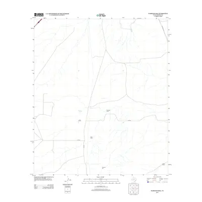
2012 Map of Florenzo Hill
USGS Topo · Published 2012About this map
Florenzo Hill rises above a landscape of arid drainages and rural infrastructure in this western Texas corridor. The terrain is defined by the ephemeral watercourses of Fivemile Draw, Sotol Draw, and Casey Draw, which channel seasonal runoff through the high desert. Evidence of ranching operations and water management appears at the Sparks Windmill and the nearby Ninemile Spring, both critical landmarks for navigating this sparsely populated section of Reeves County.
Find a feature on this map
11 named features on this map. Tap any name to fly to it.
Don’t see what you’re looking for? This feature index may not catch every label — zoom into the map to look around manually.
Map Details
Editions of this 2012 Florenzo Hill Map
This is the sole edition of this map. No revisions or reprints were ever made.
Other maps of this area

1921 · Toyah
USGS Topo · 1:125,000

1954 · Pecos
USGS Topo · 1:250,000

1955 · Saragosa
USGS Topo · 1:62,500

1957 · Pecos
USGS Topo · 1:250,000

1970 · Hermosa SW
USGS Topo · 1:24,000

1970 · Florenzo Hill
USGS Topo · 1:24,000

1970 · Toyah
USGS Topo · 1:24,000
1970 · Gozar
USGS Topo · 1:24,000
1970 · Toyah SW
USGS Topo · 1:24,000
1970 · Sotol Hill
USGS Topo · 1:24,000