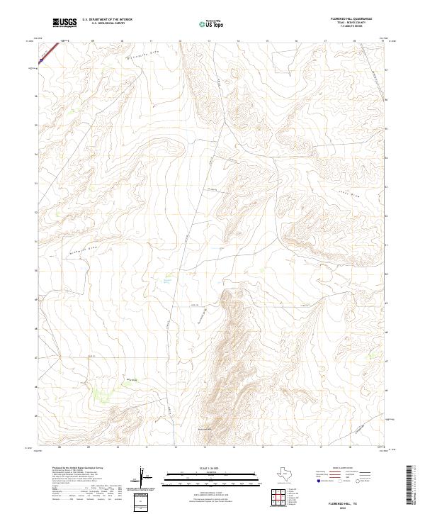
2022 Map of Florenzo Hill
USGS Topo · Published 2022About this map
Florenzo Hill rises as a subtle but defining landmark in this western Texas landscape within Reeves County. The terrain is characterized by an intricate drainage system, with seasonal watercourses like Billingslea Draw and Jones Draw cutting through the arid topography. The presence of Ninemile Spring suggests a rare reliable water source in an area otherwise dominated by these dry washes. Transport through the region follows a sparse grid of rural county roads and specialized infrastructure, including the aptly named Oil Field Rd, which indicates the area's industrial importance to the regional economy. Beyond the local network, Ranch Rd 2903 and a portion of the I 20 SVC Rd provide the primary links between the grazing lands and the wider highway system of the Permian Basin.
Find a feature on this map
15 named features on this map. Tap any name to fly to it.
Don’t see what you’re looking for? This feature index may not catch every label — zoom into the map to look around manually.
Map Details
Editions of this 2022 Florenzo Hill Map
This is the sole edition of this map. No revisions or reprints were ever made.
Other maps of this area

1921 · Toyah
USGS Topo · 1:125,000

1954 · Pecos
USGS Topo · 1:250,000

1955 · Saragosa
USGS Topo · 1:62,500

1957 · Pecos
USGS Topo · 1:250,000

1970 · Hermosa SW
USGS Topo · 1:24,000

1970 · Florenzo Hill
USGS Topo · 1:24,000

1970 · Toyah
USGS Topo · 1:24,000
1970 · Gozar
USGS Topo · 1:24,000
1970 · Toyah SW
USGS Topo · 1:24,000
1970 · Sotol Hill
USGS Topo · 1:24,000