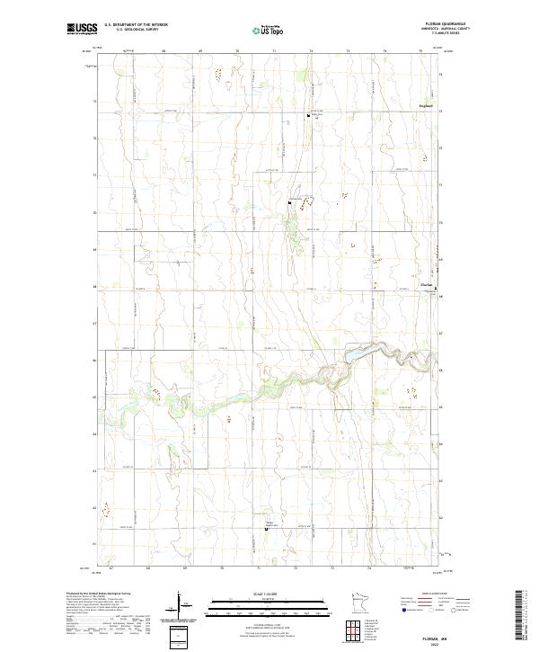
2022 Map of Florian
USGS Topo · Published 2022About this map
The Tamarac River meanders across this rural section of Marshall County, defining the drainage patterns for a landscape dominated by a strict orthogonal road grid. In the northeast, the small settlement of Englund and the community of Florian serve as the primary focal points of human activity in this agricultural region. This 2022 survey documents a series of established country burial grounds, including the Salem Cem and Florian Cem, which provide essential touchpoints for genealogical research and local heritage. Further south, the Assumption Cem and Wanger Baptist Cem sit among the section lines, indicating the persistent distribution of rural congregations. The map reflects the enduring township and range system, showing how county highways like Co Hwy 1 and Co Hwy 6 connect these isolated clusters of settlement across the flat Minnesota terrain.
Find a feature on this map
31 named features on this map. Tap any name to fly to it.
Don’t see what you’re looking for? This feature index may not catch every label — zoom into the map to look around manually.
Map Details
Editions of this 2022 Florian Map
This is the sole edition of this map. No revisions or reprints were ever made.
Other maps of this area

1918 · Argyle
USGS Topo · 1:62,500

1939 · Kennedy
USGS Topo · 1:62,500

1941 · Kennedy
USGS Topo · 1:62,500

1952 · Thief River Falls
USGS Topo · 1:250,000

1954 · Stephen
USGS Topo · 1:62,500

1956 · Thief River Falls
USGS Topo · 1:250,000

1956 · Karlstad
USGS Topo · 1:62,500

1956 · Florian
USGS Topo · 1:62,500

1957 · Thief River Falls
USGS Topo · 1:250,000

1967 · Thief River Falls
USGS Topo · 1:250,000