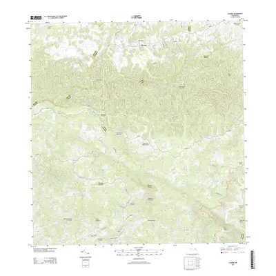
2013 Map of Florida
USGS Topo · Published 2013About this map
Florida serves as the primary municipal hub in this region of Puerto Rico, situated amidst a complex network of steep peaks and river valleys. The town is connected by several local thoroughfares, including Calle David Lopez and Camino Florida, which navigate the northern terrain near Loma Correa. To the south, the landscape becomes increasingly dramatic, marked by prominent elevations such as Cerro Magoyo and Cerro Palo de Cafe.
Find a feature on this map
49 named features on this map. Tap any name to fly to it.
Don’t see what you’re looking for? This feature index may not catch every label — zoom into the map to look around manually.
Map Details
Editions of this 2013 Florida Map
This is the sole edition of this map. No revisions or reprints were ever made.
Other maps of this area

1942 · Manati
USGS Topo · 1:30,000

1942 · Arecibo
USGS Topo · 1:30,000

1942 · Barceloneta
USGS Topo · 1:30,000

1943 · Utuado NE
USGS Topo · 1:10,000

1946 · Barceloneta
USGS Topo · 1:30,000

1946 · Utuado
USGS Topo · 1:30,000

1946 · Ciales
USGS Topo · 1:30,000

1946 · Jayuya
USGS Topo · 1:30,000

1946 · Arecibo
USGS Topo · 1:30,000

1946 · Florida
USGS Topo · 1:30,000