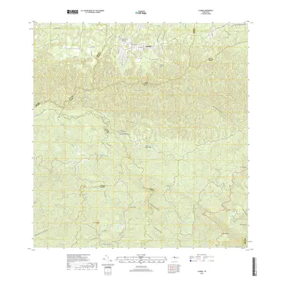
2018 Map of Florida
USGS Topo · Published 2018About this map
The municipality of Florida serves as the primary urban center in this detailed 2018 survey, situated near the northern edge of the mountainous interior of the Island of Puerto Rico. The landscape is defined by its complex network of ridges and watercourses, with the Cementerio Municipal de Florida located just west of the town center. Local transportation follows the winding contours of the terrain, including named routes such as Cam Flor de Alba and Carr Los Ajos.
Find a feature on this map
60 named features on this map. Tap any name to fly to it.
Don’t see what you’re looking for? This feature index may not catch every label — zoom into the map to look around manually.
Map Details
Editions of this 2018 Florida Map
This is the sole edition of this map. No revisions or reprints were ever made.
Other maps of this area

1942 · Manati
USGS Topo · 1:30,000

1942 · Arecibo
USGS Topo · 1:30,000

1942 · Barceloneta
USGS Topo · 1:30,000

1943 · Utuado NE
USGS Topo · 1:10,000

1946 · Barceloneta
USGS Topo · 1:30,000

1946 · Utuado
USGS Topo · 1:30,000

1946 · Ciales
USGS Topo · 1:30,000

1946 · Jayuya
USGS Topo · 1:30,000

1946 · Arecibo
USGS Topo · 1:30,000

1946 · Florida
USGS Topo · 1:30,000