
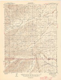
1944 Map of Flournoy
USGS Topo · Published 1944About this map
Thomes Creek and Stony Creek dominate this 1940s landscape, illustrating the intricate drainage patterns of the western Sacramento Valley foothills. The transition from the flatlands of the valley into the rising elevations of Table Mtn is marked by numerous seasonal drainages such as Squaw Hollow Creek and Burch Creek. This era shows the critical role of water management in the region, centered on the Diversion Dam and a developing Canal system designed to redirect flows for local use.
Find a feature on this map
35 named features on this map. Tap any name to fly to it.
Don’t see what you’re looking for? This feature index may not catch every label — zoom into the map to look around manually.
Map Details
Editions of this 1944 Flournoy Map
2 editions found
Other maps of this area

1890 · Red Bluff
USGS Topo · 1:250,000

1894 · Red Bluff
USGS Topo · 1:250,000

1904 · Vina
USGS Topo · 1:62,500

1904 · Walker Creek
USGS Topo · 1:31,680

1905 · Tehama
USGS Topo · 1:62,500

1906 · Willows
USGS Topo · 1:62,500

1914 · Kirkwood
USGS Topo · 1:31,680

1914 · Orland
USGS Topo · 1:31,680

1919 · Fruto
USGS Topo · 1:62,500

1919 · Elk Creek
USGS Topo · 1:62,500