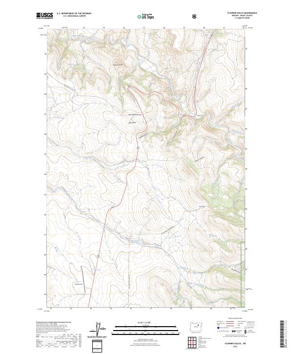
2023 Map of Flowers Gulch
USGS Topo · Published 2023About this map
The Middle Fork John Day River snakes across the northern reaches of this Grant County landscape, carving through a series of significant elevations and named drainages. Higher ground is defined by Sugar Loaf Mtn and the prominent Ritter Butte, which rises near its eponymous Ritter Butte Summit. To the south, the terrain descends into the namesake Flowers Gulch and the clearing at Weddle Field, illustrating a territory of high ridges separated by an intricate network of waterways like Granite Creek and Willow Creek.
Find a feature on this map
31 named features on this map. Tap any name to fly to it.
Don’t see what you’re looking for? This feature index may not catch every label — zoom into the map to look around manually.
Map Details
Editions of this 2023 Flowers Gulch Map
This is the sole edition of this map. No revisions or reprints were ever made.
Other maps of this area

1949 · Long Creek
USGS Topo · 1:62,500

1949 · Susanville
USGS Topo · 1:62,500

1950 · Ritter
USGS Topo · 1:62,500

1951 · Susanville
USGS Topo · 1:62,500

1951 · Long Creek
USGS Topo · 1:62,500

1951 · Dale
USGS Topo · 1:62,500

1952 · Ritter
USGS Topo · 1:62,500

1955 · Canyon City
USGS Topo · 1:250,000

1959 · Canyon City
USGS Topo · 1:250,000

1980 · Monument
USGS Topo · 1:100,000