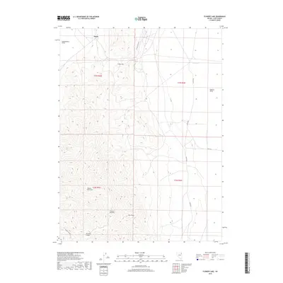
2018 Map of Flowery Lake
USGS Topo · Published 2018About this map
Hogan sits at the northern edge of this high-desert landscape where the steep elevations of the Pequop Mountains divide two distinct basins. This interior drainage system creates a environment where seasonal water gathers at Flowery Lake, situated on the eastern flats. The map documents a critical corridor for travel through the range, notably via Flower Pass and Flowery Lake Pass, which provide passage between the Independence Valley and Goshute Valley. To the south, the terrain becomes increasingly complex around Twin Peaks and the carved path of Ninemile Canyon. The infrastructure is primarily defined by long-distance desert routes like Shafter Rd and the RR Maintenance Rd, reflecting a landscape geared toward transportation and maintenance in Elko County’s remote high country.
Find a feature on this map
17 named features on this map. Tap any name to fly to it.
Don’t see what you’re looking for? This feature index may not catch every label — zoom into the map to look around manually.
Map Details
Editions of this 2018 Flowery Lake Map
This is the sole edition of this map. No revisions or reprints were ever made.
Other maps of this area

1953 · Spruce Mountain 4
USGS Topo · 1:62,500

1955 · Elko
USGS Topo · 1:250,000

1958 · Elko
USGS Topo · 1:250,000

1962 · Elko
USGS Topo · 1:250,000

1965 · Elko
USGS Topo · 1:250,000

1968 · Independence Valley SW
USGS Topo · 1:24,000

1968 · Independence Valley SE
USGS Topo · 1:24,000

1971 · Shafter
USGS Topo · 1:24,000

1971 · Decoy
USGS Topo · 1:24,000

1972 · Decoy SW
USGS Topo · 1:24,000