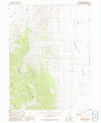
1986 Map of Flowery Lake
USGS Topo · Published 1986About this map
The Pequop Mountains dominate the central topography of this Great Basin landscape, creating a high-altitude divide between two distinct basins. To the east lies the broad expanse of Goshute Valley, where the ephemeral Flowery Lake collects seasonal runoff. On the western side of the range, the terrain descends into Independence Valley, anchored by the settlement at Hogan.
Find a feature on this map
9 named features on this map. Tap any name to fly to it.
Don’t see what you’re looking for? This feature index may not catch every label — zoom into the map to look around manually.
Map Details
Editions of this 1986 Flowery Lake Map
This is the sole edition of this map. No revisions or reprints were ever made.
Other maps of this area

1953 · Spruce Mountain 4
USGS Topo · 1:62,500

1955 · Elko
USGS Topo · 1:250,000

1958 · Elko
USGS Topo · 1:250,000

1962 · Elko
USGS Topo · 1:250,000

1965 · Elko
USGS Topo · 1:250,000

1968 · Independence Valley SW
USGS Topo · 1:24,000

1968 · Independence Valley SE
USGS Topo · 1:24,000

1971 · Shafter
USGS Topo · 1:24,000

1971 · Decoy
USGS Topo · 1:24,000

1972 · Decoy SW
USGS Topo · 1:24,000