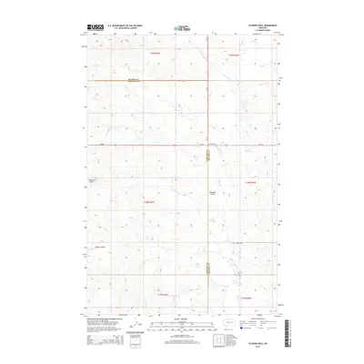
2014 Map of Flowing Well
USGS Topo · Published 2014About this map
Flowing Well serves as the focal point of this Eastern Montana landscape, situated at the intersection of MT-200 and MT-24. The area is defined by a complex network of seasonal drainage patterns carving through the high plains, including the expansive Patterson Coulee and Steves Coulee. These landforms dictate the placement of ranching outposts like Whiteside Ranch, where human activity adapts to the constraints of the arid environment.
Find a feature on this map
27 named features on this map. Tap any name to fly to it.
Don’t see what you’re looking for? This feature index may not catch every label — zoom into the map to look around manually.
Map Details
Editions of this 2014 Flowing Well Map
This is the sole edition of this map. No revisions or reprints were ever made.
Other maps of this area

1954 · Jordan
USGS Topo · 1:250,000

1956 · Jordan
USGS Topo · 1:250,000

1958 · Jordan
USGS Topo · 1:250,000

1964 · Jordan
USGS Topo · 1:250,000

1965 · Hedstrom Lake
USGS Topo · 1:24,000

1965 · Whiteside Ranch
USGS Topo · 1:24,000

1965 · Hedstrom Lake NW
USGS Topo · 1:24,000

1967 · Coal Creek
USGS Topo · 1:24,000

1967 · Frank Coulee
USGS Topo · 1:24,000
1983 · Flowing Well
USGS Topo · 1:24,000