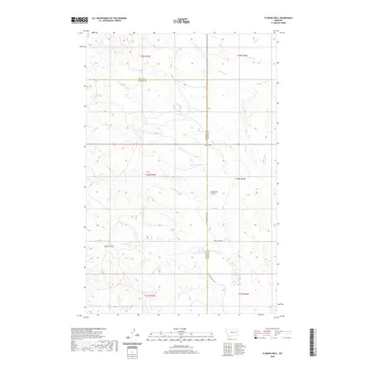
2020 Map of Flowing Well
USGS Topo · Published 2020About this map
Flowing Well serves as a central landmark in this high plains landscape straddling the line between McCone and Garfield counties. The terrain is defined by a network of drainage systems, including Timber Cr, Coal Cr, and Soda Cr, which have carved out significant topographic features such as Patterson Coulee and Steves Coulee. This 2020 survey illustrates a sparsely populated ranching or grazing environment where the primary human infrastructure consists of rural corridors like S Flowing Wells Rd and Skull Creek Rd. The map provides a contemporary view of these eastern Montana badlands, showing how water and wind continue to shape the coulees and creek beds while the historic county boundary remains a primary geographic divider in this quiet stretch of the frontier.
Find a feature on this map
18 named features on this map. Tap any name to fly to it.
Don’t see what you’re looking for? This feature index may not catch every label — zoom into the map to look around manually.
Map Details
Editions of this 2020 Flowing Well Map
This is the sole edition of this map. No revisions or reprints were ever made.
Other maps of this area

1954 · Jordan
USGS Topo · 1:250,000

1956 · Jordan
USGS Topo · 1:250,000

1958 · Jordan
USGS Topo · 1:250,000

1964 · Jordan
USGS Topo · 1:250,000

1965 · Hedstrom Lake
USGS Topo · 1:24,000

1965 · Whiteside Ranch
USGS Topo · 1:24,000

1965 · Hedstrom Lake NW
USGS Topo · 1:24,000

1967 · Coal Creek
USGS Topo · 1:24,000

1967 · Frank Coulee
USGS Topo · 1:24,000
1983 · Flowing Well
USGS Topo · 1:24,000