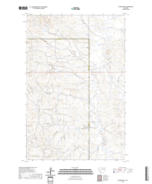
2024 Map of Flowing Well
USGS Topo · Published 2024About this map
The boundary between McCone Co and Garfield Co bisects this stretch of the eastern Montana plains. The landscape is defined by an intricate drainage system that feeds toward the Missouri River basin, featuring prominent watercourses such as Crooked Creek and Timber Creek. These streams have carved a complex network of coulees and draws into the high prairie, with Patterson Coulee and Skull Creek serving as significant topographic landmarks. Development in the region is sparse, consisting primarily of section-line roads and ranch access routes like S Flowing Wells Rd and Skull Creek Rd. The map illustrates the traditional township and range system, providing a precise look at the land partitions and natural watersheds including Coal Creek and Soda Creek that have shaped grazing and ranching patterns across these counties.
Find a feature on this map
16 named features on this map. Tap any name to fly to it.
Don’t see what you’re looking for? This feature index may not catch every label — zoom into the map to look around manually.
Map Details
Editions of this 2024 Flowing Well Map
This is the sole edition of this map. No revisions or reprints were ever made.
Other maps of this area

1954 · Jordan
USGS Topo · 1:250,000

1956 · Jordan
USGS Topo · 1:250,000

1958 · Jordan
USGS Topo · 1:250,000

1964 · Jordan
USGS Topo · 1:250,000

1965 · Hedstrom Lake
USGS Topo · 1:24,000

1965 · Whiteside Ranch
USGS Topo · 1:24,000

1965 · Hedstrom Lake NW
USGS Topo · 1:24,000

1967 · Coal Creek
USGS Topo · 1:24,000

1967 · Frank Coulee
USGS Topo · 1:24,000
1983 · Flowing Well
USGS Topo · 1:24,000