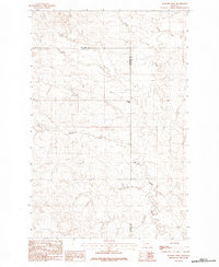
1983 Map of Flowing Well
USGS Topo · Published 1983About this map
Flowing Well serves as the central namesake for this high-plains landscape where the borders of McCone and Garfield counties meet. The terrain is defined by a dendritic network of drainage systems, most notably Patterson Coulee, which carves through the central portion of the quadrangle. These coulees and creek beds dictate the sparse human footprint in this part of Montana, where the availability of water is the primary driver of name and place. Several significant waterways converge or traverse the area, including the winding paths of Timber Creek and Crooked Creek. Smaller seasonal drainages like Coal Creek, Soda Creek, and Skull Creek further segment the land, illustrating the complex erosion patterns typical of the region's topography. This provisional map provides an important record of the physical landscape before modern developments, highlighting the isolation and specific geological features that characterize this stretch of the northern plains.
Find a feature on this map
9 named features on this map. Tap any name to fly to it.
Don’t see what you’re looking for? This feature index may not catch every label — zoom into the map to look around manually.
Map Details
Editions of this 1983 Flowing Well Map
This is the sole edition of this map. No revisions or reprints were ever made.
Other maps of this area

1954 · Jordan
USGS Topo · 1:250,000

1956 · Jordan
USGS Topo · 1:250,000

1958 · Jordan
USGS Topo · 1:250,000

1964 · Jordan
USGS Topo · 1:250,000

1965 · Hedstrom Lake
USGS Topo · 1:24,000

1965 · Whiteside Ranch
USGS Topo · 1:24,000

1965 · Hedstrom Lake NW
USGS Topo · 1:24,000

1967 · Coal Creek
USGS Topo · 1:24,000

1967 · Frank Coulee
USGS Topo · 1:24,000
1983 · Cemetery Coulee
USGS Topo · 1:24,000