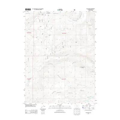
2013 Map of Floyd Peak
USGS Topo · Published 2013About this map
Routt National Forest dominates this section of the Colorado high country, centered on the prominent summit of Floyd Peak. The landscape is defined by a dense network of drainage systems and primitive trails that reflect the area's role as a recreational and conservation corridor. Water from the Elk River and S Fork Elk River is fed by numerous named creeks including Roaring Fork Cr, Ditch Cr, and Coulton Creek, where the Coulton Creek Campground provides a base for exploration. The southeastern corner is particularly striking for its concentration of alpine waters, featuring Fish Hawk Lake, Snowstorm Lake, Lake Margaret, and Lake Edward. Human presence is sparse, marked primarily by the Wapiti Ranch and various forest trails like the Luna Lake Trail and Roaring Fork Trail, which navigate the steep elevations between Burn Ridge and Bear Canyon.
Find a feature on this map
37 named features on this map. Tap any name to fly to it.
Don’t see what you’re looking for? This feature index may not catch every label — zoom into the map to look around manually.
Map Details
Editions of this 2013 Floyd Peak Map
This is the sole edition of this map. No revisions or reprints were ever made.
Other maps of this area

1911 · Hahns Peak
USGS Topo · 1:125,000

1913 · Hahns Peak
USGS Topo · 1:125,000

1954 · Craig
USGS Topo · 1:250,000

1955 · Buffalo Pass
USGS Topo · 1:24,000

1955 · Mount Zirkel
USGS Topo · 1:24,000

1955 · Mount Ethel
USGS Topo · 1:24,000

1955 · Mount Ethel
USGS Topo · 1:62,500

1956 · Pearl
USGS Topo · 1:62,500

1957 · Craig
USGS Topo · 1:250,000

1958 · Craig
USGS Topo · 1:250,000