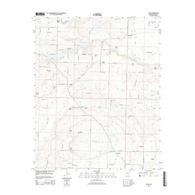
2014 Map of Floyd
USGS Topo · Published 2014About this map
Floyd serves as a central hub in this White County landscape, where the foothills of the Interior Highlands begin to give way to the drainage systems of the Bayou Des Arc. The terrain is defined by a series of prominent ridges and peaks, such as Red Bluff, Nipper Mtn, and Waldon Mtn, which separate the various creek valleys. Numerous family-named landmarks and rural settlements like Gravel Hill, Harmony, and Antioch indicate a long-standing agricultural and residential pattern.
Find a feature on this map
137 named features on this map. Tap any name to fly to it.
Don’t see what you’re looking for? This feature index may not catch every label — zoom into the map to look around manually.
Map Details
Editions of this 2014 Floyd Map
This is the sole edition of this map. No revisions or reprints were ever made.
Other maps of this area

1953 · Memphis
USGS Topo · 1:250,000

1956 · Memphis
USGS Topo · 1:250,000

1956 · Russellville
USGS Topo · 1:250,000

1962 · Letona
USGS Topo · 1:24,000

1963 · Rose Bud
USGS Topo · 1:24,000

1963 · Garner
USGS Topo · 1:24,000

1963 · Floyd
USGS Topo · 1:24,000

1963 · Mount Vernon
USGS Topo · 1:24,000

1963 · Sidon
USGS Topo · 1:24,000
1963 · Beebe
USGS Topo · 1:24,000