
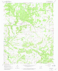
1963 Map of Rose Bud
USGS Topo · Published 1964About this map
The community of Rose Bud serves as the focal point of this 1963 survey, situated at the junction of Ark 25 and Ark 31. The landscape is defined by the winding course of Cadron Creek and its many tributaries, such as East Fork Cadron Creek and Clear Creek, which carve through the prominent uplands of Bluff Mountain and Starkey Mountain. This era shows a well-established network of rural institutions, including Plants Chapel and Mt Bethel Ch, alongside family-named landmarks like Wortham Hill and Hart Hill.
Find a feature on this map
49 named features on this map. Tap any name to fly to it.
Don’t see what you’re looking for? This feature index may not catch every label — zoom into the map to look around manually.
Map Details
Editions of this 1963 Rose Bud Map
2 editions found
Other maps of this area

1953 · Memphis
USGS Topo · 1:250,000

1956 · Memphis
USGS Topo · 1:250,000

1956 · Russellville
USGS Topo · 1:250,000

1963 · Floyd
USGS Topo · 1:24,000

1963 · Quitman
USGS Topo · 1:24,000

1963 · West Pangburn
USGS Topo · 1:24,000

1963 · Enola
USGS Topo · 1:24,000

1963 · Mount Vernon
USGS Topo · 1:24,000

1963 · Sidon
USGS Topo · 1:24,000
1963 · Barney
USGS Topo · 1:24,000