
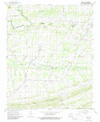
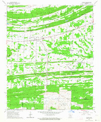
1963 Map of Enola
USGS Topo · Published 1964About this map
The settlement of Enola serves as the focal point of this Faulkner County survey, where small rural communities are connected by a network of light-duty roads and unimproved trails. The landscape is defined by the transition from the rolling hills of Cascade Mountain in the south to the fertile drainages of Muddy Bayou and Turkey Creek further north. This era reveals a deeply established social geography, evidenced by numerous country houses of worship such as Naylor Ch, Bethlehem Ch, and Sharon Ch. Local industry and geology are noted through the presence of Shale Pits and a Quarry near the base of the ridge. The map also identifies historic family names through landmarks like Garland Mountain and Heffington Cem, providing significant detail for those researching the early 1960s footprint of the Enola and Naylor areas before modern suburban expansion reached this part of the state.
Find a feature on this map
36 named features on this map. Tap any name to fly to it.
Don’t see what you’re looking for? This feature index may not catch every label — zoom into the map to look around manually.
Map Details
Editions of this 1963 Enola Map
2 editions found
Other maps of this area

1956 · Russellville
USGS Topo · 1:250,000

1961 · Conway
USGS Topo · 1:62,500

1961 · Bee Branch
USGS Topo · 1:62,500

1961 · Guy
USGS Topo · 1:24,000
1961 · Holland
USGS Topo · 1:24,000
1961 · Hamlet
USGS Topo · 1:24,000

1963 · Rose Bud
USGS Topo · 1:24,000

1963 · Mount Vernon
USGS Topo · 1:24,000
1963 · Mountain Springs
USGS Topo · 1:24,000
1963 · Vilonia
USGS Topo · 1:24,000