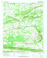
1961 Map of Holland
USGS Topo · Published 1966About this map
Holland and the surrounding rural landscape of Faulkner County are defined by a series of prominent ridges and bottomlands carved by the Cadron Fork. The terrain is characterized by long, east-west trending heights such as Clinton Mountain, Hardin Hill, and the significant Dun Hill system to the south. These ridges are broken by natural passes like Bailey Gap, Acklin Gap, and Mabry Gap, which dictated the early travel patterns of this region.
Find a feature on this map
45 named features on this map. Tap any name to fly to it.
Don’t see what you’re looking for? This feature index may not catch every label — zoom into the map to look around manually.
Map Details
Editions of this 1961 Holland Map
2 editions found
Other maps of this area

1956 · Russellville
USGS Topo · 1:250,000

1961 · Conway
USGS Topo · 1:24,000

1961 · Conway
USGS Topo · 1:62,500

1961 · Bee Branch
USGS Topo · 1:62,500

1961 · Greenbrier
USGS Topo · 1:24,000

1961 · Damascus
USGS Topo · 1:24,000

1961 · Guy
USGS Topo · 1:24,000
1961 · Hamlet
USGS Topo · 1:24,000

1963 · Enola
USGS Topo · 1:24,000
1963 · Vilonia
USGS Topo · 1:24,000