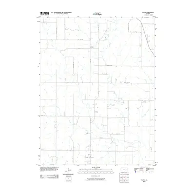
2009 Map of Flush
USGS Topo · Published 2009About this map
Flush serves as the central settlement point in this Kansas landscape, surrounded by a complex network of waterways and rural corridors. The terrain is defined by the drainage systems of Pleasant Run, Rock Creek, and Hopkins Creek, which create a varied topography across the quadrangle. Many of the local roads, such as Hopkins Creek Rd, Pleasant Run Rd, and Myers Valley Rd, follow the natural contours of the land or these established stream beds, reflecting a long history of agricultural navigation. To the north, the Admatha Cemetery stands as a significant genealogical landmark, situated near the intersection of Loux Rd and Admantha Rd. The prevalence of family and descriptive road names like Antons Rd, Gier Ln, and Morning Glory Rd suggests a deeply rooted community structure as it existed in the early 21st century.
Find a feature on this map
38 named features on this map. Tap any name to fly to it.
Don’t see what you’re looking for? This feature index may not catch every label — zoom into the map to look around manually.
Map Details
Editions of this 2009 Flush Map
This is the sole edition of this map. No revisions or reprints were ever made.
Other maps of this area

1886 · Junction City
USGS Topo · 1:125,000

1889 · Wamego
USGS Topo · 1:125,000

1889 · Junction City
USGS Topo · 1:125,000

1894 · Junction City
USGS Topo · 1:125,000

1894 · Wamego
USGS Topo · 1:125,000

1947 · Manhattan
USGS Topo · 1:62,500

1950 · Manhattan
USGS Topo · 1:24,000

1953 · Wamego
USGS Topo · 1:24,000

1953 · St George
USGS Topo · 1:24,000
1955 · Manhattan
USGS Topo · 1:24,000