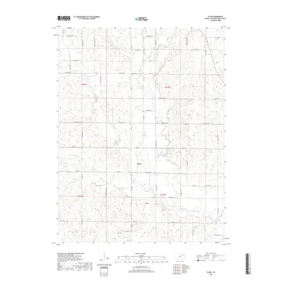
2018 Map of Flush
USGS Topo · Published 2018About this map
Flush serves as the central focal point of this Pottawatomie County landscape, situated where Flush Rd meets Louisville Rd. The terrain is defined by a dense network of drainage, where Pleasant Run Cr and its many tributaries, such as Hopkins Cr and Wilson Cr, have carved deep draws through the uplands. This 2018 survey reveals a rural structure still heavily influenced by section lines and natural topography, with naming conventions like Buffalo Run Rd and Antelope Run Rd reflecting the area's prairie heritage.
Find a feature on this map
51 named features on this map. Tap any name to fly to it.
Don’t see what you’re looking for? This feature index may not catch every label — zoom into the map to look around manually.
Map Details
Editions of this 2018 Flush Map
This is the sole edition of this map. No revisions or reprints were ever made.
Other maps of this area

1886 · Junction City
USGS Topo · 1:125,000

1889 · Wamego
USGS Topo · 1:125,000

1889 · Junction City
USGS Topo · 1:125,000

1894 · Junction City
USGS Topo · 1:125,000

1894 · Wamego
USGS Topo · 1:125,000

1947 · Manhattan
USGS Topo · 1:62,500

1950 · Manhattan
USGS Topo · 1:24,000

1953 · Wamego
USGS Topo · 1:24,000

1953 · St George
USGS Topo · 1:24,000
1955 · Manhattan
USGS Topo · 1:24,000