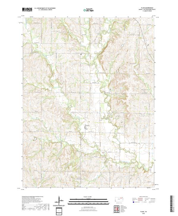
2022 Map of Flush
USGS Topo · Published 2022About this map
The small settlement of Flush serves as the focal point for this rural landscape in Pottawatomie County, where the plains are deeply etched by a network of drainage creeks. Religious and community history is anchored by the Saint Joseph's Catholic Cem near the center of the sheet and the Admatha Cem further north. This agricultural region is defined by the winding paths of several watercourses, including Rock Cr, Pleasant Run Cr, and Hopkins Cr, which break up the traditional section-line road grid. The road names, such as Flint Rock Rd and Antelope Run Rd, reflect the natural character and topography of the area. Further south, the map details the terrain around Elm Slough and Elbo Cr, illustrating the drainage patterns that have shaped local farm boundaries and travel routes for generations.
Find a feature on this map
54 named features on this map. Tap any name to fly to it.
Don’t see what you’re looking for? This feature index may not catch every label — zoom into the map to look around manually.
Map Details
Editions of this 2022 Flush Map
This is the sole edition of this map. No revisions or reprints were ever made.
Other maps of this area

1886 · Junction City
USGS Topo · 1:125,000

1889 · Wamego
USGS Topo · 1:125,000

1889 · Junction City
USGS Topo · 1:125,000

1894 · Junction City
USGS Topo · 1:125,000

1894 · Wamego
USGS Topo · 1:125,000

1947 · Manhattan
USGS Topo · 1:62,500

1950 · Manhattan
USGS Topo · 1:24,000

1953 · Wamego
USGS Topo · 1:24,000

1953 · St George
USGS Topo · 1:24,000
1955 · Manhattan
USGS Topo · 1:24,000