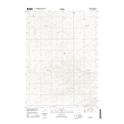
2015 Map of Fly Draw
USGS Topo · Published 2015About this map
The N Fork Dry Fork Cheyenne River and S Fork Dry Fork Cheyenne River converge in this high plains landscape, defining a complex drainage system across Converse County. This area is characterized by significant topographic relief, most notably at Pine Ridge and along the breaks of Pine Gulch. The hydrology is further articulated by numerous seasonal watercourses, including Fly Draw and Snake Charmer Draw, which feed into the Cheyenne River system. This 2015 survey illustrates the modern grid of the Public Land Survey System, showing the townships and ranges that have governed Wyoming land ownership for over a century. The intricate network of small streams like Sand Cr and Salt Cr highlights the erosion patterns typical of the region's sedimentary geology.
Find a feature on this map
16 named features on this map. Tap any name to fly to it.
Don’t see what you’re looking for? This feature index may not catch every label — zoom into the map to look around manually.
Map Details
Editions of this 2015 Fly Draw Map
This is the sole edition of this map. No revisions or reprints were ever made.
Other maps of this area

1955 · Newcastle
USGS Topo · 1:250,000

1955 · Arminto
USGS Topo · 1:250,000

1958 · Arminto
USGS Topo · 1:250,000

1958 · Newcastle
USGS Topo · 1:250,000

1959 · Fifty-Five Ranch
USGS Topo · 1:62,500

1959 · Edgerton
USGS Topo · 1:62,500

1959 · Ormsby Draw
USGS Topo · 1:62,500

1960 · Ross
USGS Topo · 1:62,500

1962 · Arminto
USGS Topo · 1:250,000

1979 · Bill
USGS Topo · 1:100,000