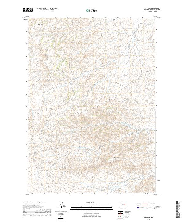
2021 Map of Fly Draw
USGS Topo · Published 2021About this map
The N Fork Dry Fork Cheyenne River, S Fork Dry Fork Cheyenne River, and Middle Fork Dry Fork Cheyenne River define the intricate drainage network of this Converse County landscape. The topography is dominated by the prominent Pine Ridge and Pine Gulch, which overlook a series of seasonal waterways including Sand Cr and the creatively named Snake Charmer Draw. This 2021 survey by the U.S. Geological Survey details the high plains environment where subtle elevation changes guide the flow of Marsh Draw and Fly Draw toward the larger Cheyenne River tributaries. The map reveals the expansive nature of the Wyoming rangeland, characterized by traditional township and range divisions and a sparse network of ranch roads that navigate the complex system of draws and ridges.
Find a feature on this map
16 named features on this map. Tap any name to fly to it.
Don’t see what you’re looking for? This feature index may not catch every label — zoom into the map to look around manually.
Map Details
Editions of this 2021 Fly Draw Map
This is the sole edition of this map. No revisions or reprints were ever made.
Other maps of this area

1955 · Newcastle
USGS Topo · 1:250,000

1955 · Arminto
USGS Topo · 1:250,000

1958 · Arminto
USGS Topo · 1:250,000

1958 · Newcastle
USGS Topo · 1:250,000

1959 · Fifty-Five Ranch
USGS Topo · 1:62,500

1959 · Edgerton
USGS Topo · 1:62,500

1959 · Ormsby Draw
USGS Topo · 1:62,500

1960 · Ross
USGS Topo · 1:62,500

1962 · Arminto
USGS Topo · 1:250,000

1979 · Bill
USGS Topo · 1:100,000