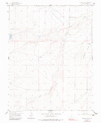
1959 Map of Flying A Ranch
USGS Topo · Published 1983About this map
Flying A Ranch sits at the center of this 1959 ranching landscape in Pueblo County, where water management defines the arid terrain. The drainage of Chicosa Creek and the deep cut of Hungerford Hollow organize the topography, supported by a network of man-made water features including Nepesta Reservoir (Number Five) and Dotson Res. These reservoirs, along with Hungerford Lake and several Artesian Wells, illustrate the essential infrastructure required for large-scale cattle operations in the Colorado high plains. Long stretches of Fence lines and a utility Pipeline cross the sections, marking property boundaries and industrial improvements in a region defined more by its natural contours and hydrology than by urban settlement.
Find a feature on this map
10 named features on this map. Tap any name to fly to it.
Don’t see what you’re looking for? This feature index may not catch every label — zoom into the map to look around manually.
Map Details
Editions of this 1959 Flying A Ranch Map
2 editions found
Other maps of this area

1891 · Nepesta
USGS Topo · 1:125,000

1891 · Apishapa
USGS Topo · 1:125,000

1893 · Nepesta
USGS Topo · 1:125,000

1893 · Apishapa
USGS Topo · 1:125,000

1897 · Apishapa
USGS Topo · 1:125,000

1904 · Nepesta
USGS Topo · 1:125,000

1954 · Trinidad
USGS Topo · 1:250,000

1954 · Pueblo
USGS Topo · 1:250,000

1955 · Trinidad
USGS Topo · 1:250,000

1957 · Pueblo
USGS Topo · 1:250,000